politics
WHO OWNS KASHMIR’S WATER?
By Sohail Bhat | Tue Sep 08 2026
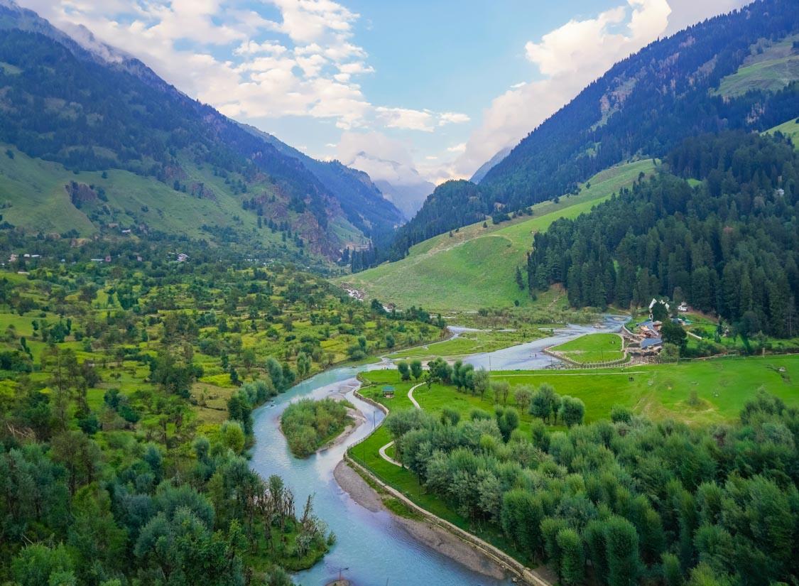
The rivers of Kashmir have always been more than scenery. They have carried people, shaped settlements, fed fields, powered machines and remained at the centre of one of South Asia’s enduring conflicts. As the old arrangements around water enter uncertain territory, a more immediate question is emerging inside Kashmir itself: who benefits from the water that flows through it?
There are places in Kashmir where water is so abundant that it seems impossible to imagine anyone going without it.
A stream comes down from a mountain and disappears beneath a village bridge. Another runs through an orchard before joining a larger river. In the higher reaches, snow gathers through the winter and waits for spring. Springs emerge from rock. Glaciers feed narrow valleys. The Jhelum gathers water from tributaries before carrying it towards the western horizon. The Chenab cuts through some of the most difficult terrain in the region, gathering force as it travels through the mountains.
From a distance, this looks like abundance without an argument. But Kashmir has never been simply a land of abundant water. Water here has always been about where it is, when it arrives, who can reach it, what can be built around it, who gets the electricity generated from it and who bears the consequences when it becomes too much or too little.
The contradiction is becoming harder to ignore. A region with enormous rivers can have villages worrying about drinking water. A valley crossed by the Jhelum can watch its river rise towards its banks during a cloudburst and still worry about the condition of its wetlands and flood channels. A mountain district can produce electricity from a river that seems to belong naturally to the landscape while local communities continue to debate what they receive in return.
And now the question has acquired a much larger strategic dimension.
And now the question has acquired a much larger strategic dimension.
The Indus Waters Treaty, signed by India and Pakistan in 1960, divided the waters of the Indus river system between the two countries. The eastern rivers, Ravi, Beas and Sutlej, were allocated for India's unrestricted use subject to the treaty's provisions. The western rivers, Indus, Jhelum and Chenab, were assigned primarily to Pakistan, while India retained specified rights for domestic use, agriculture and hydroelectric generation.
For more than six decades, this arrangement became one of the fixed points of the India Pakistan relationship. It survived wars, diplomatic breakdowns and periods when almost every other channel of communication had become difficult.
That arrangement, however, changed dramatically in 2025, when Government of India announced that the treaty would be held in abeyance. The decision came after the Pahalgam attack and was presented by New Delhi as part of its response to cross border terrorism. Pakistan argued that the treaty contained no provision for unilateral suspension. The arguments between the two countries are familiar. What is less often asked is what all this means for Kashmir.
Not Pakistan. Not New Delhi. Kashmir.
Because the rivers do not exist on maps as lines separating two countries. They rise, gather, descend and disappear through landscapes where people live. They pass farms, villages and towns. They enter turbines. They flood roads. They feed wetlands. They carry silt. They sustain orchards. They are part of the geography of everyday life.
The question therefore cannot stop at who gets the water downstream. There is another question beneath it.
Who owns the value of the water while it is still in Kashmir?
THE RIVER THAT REFUSES TO BE ORDINARY
The Jhelum begins at Verinag and gathers strength as it moves through the Valley. Several important tributaries join it before it reaches Srinagar, including the Lidder, Vishow and Rambiara. The river then continues westwards, eventually leaving the Valley and crossing into Pakistan. For Kashmiris, however, the Jhelum is not a basin statistic.
It is a memory. It is the river that children grow up beside. It is the river whose banks become crowded during summer evenings. It is the river that appears in poetry, photographs and family histories. It is also the river that became frightening in September 2014, when a catastrophic flood overwhelmed large parts of the Valley. The flood remains one of the clearest reminders that water does not recognise the categories humans impose upon it. A river can be a resource one day and a threat the next.
The Central Water Commission's assessment of the 2014 disaster found that the flood peak in the Jhelum at Sangam was around 2,500 cubic metres per second and around 3,200 cubic metres per second at Srinagar. The estimated safe carrying capacity between Sangam and Srinagar was about 900 cubic metres per second.
The difference was enormous. But the numbers tell only part of the story.
Natural flood detention areas had gradually been occupied by development. Wetlands and waterways had suffered from encroachment and siltation. The landscape that once helped absorb excess water had been weakened. This is where Kashmir's water story becomes uncomfortable.
The argument is often presented as though the only problem is how much water exists.
In reality, the more difficult question is whether Kashmir has protected the places where water is supposed to go. A river cannot be managed only by building structures around it.
A wetland is infrastructure. A flood channel is infrastructure. A spring is infrastructure.
A forested catchment is infrastructure. These things do not always appear in project reports with the same visibility as a power station or a barrage, but when they disappear, the consequences become visible very quickly.
ABUNDANCE THAT DOES NOT ALWAYS REACH THE TAP
Ask an ordinary household about water and the conversation can move in a completely different direction. The geopolitical debate may be about billions of cubic metres and the rights of upper and lower riparian’s. A family may simply want water to arrive at the tap.
A recent study of water resources in Jammu and Kashmir found considerable variation in water availability and quality across different areas. The study reported seasonal variation as a major cause of scarcity and found that many respondents experienced significant time costs in collecting water. It also recorded concerns about groundwater levels and water quality.
That is an important distinction. Water abundance at the scale of a river basin does not automatically mean water security at the household level. The two can exist side by side.
This distinction is likely to become even more important as towns expand and tourism puts additional pressure on local water systems.
A mountain spring may have been enough for a small settlement for generations. It may not be enough for a much larger settlement, particularly when the spring's recharge pattern changes or the surrounding land is altered. A stream can continue flowing while the quality of its water deteriorates.
A river can carry enormous volumes downstream while a village nearby depends on a tanker.
The question is therefore not merely how much water Kashmir has.
It is how much water Kashmir can reliably store, clean, distributes and use without destroying the systems that produce it. That is a much harder problem.
And it is a problem that cannot be solved by international diplomacy alone.
THE POWER HIDDEN INSIDE THE RIVER
There is another way in which Kashmir's water becomes valuable.
It can be turned into electricity. This is where the politics of water becomes inseparable from the politics of development. The steep gradients of the Himalayan rivers create enormous potential for hydropower. The Chenab and Jhelum systems in particular have become central to the region's power infrastructure.
Government figures presented in Parliament in December 2025 listed 3,360 megawatts of commissioned hydroelectric capacity in Jammu and Kashmir. A further 3,051.5 megawatts was listed as under construction, with another 2,449 megawatts under planning.
Those numbers are large enough to change the way a region thinks about its rivers.
A river stops being simply a river.
It becomes an energy asset.
It becomes a source of revenue.
It becomes a national infrastructure project.
It becomes part of a strategic conversation with Pakistan.
It becomes a subject for engineers, bureaucrats, environmentalists, local politicians and communities.
And somewhere beneath all these descriptions sits the person living beside the river.
What does that person receive? That question deserves more attention than it has received.
For decades, the debate over hydropower in Kashmir has often been framed around two competing claims.
One side argues that Kashmir possesses enormous untapped energy potential and that the region cannot afford to leave it unused.
The other points to displacement, environmental costs, altered river systems, construction impacts and the limited local economic benefits that communities sometimes feel they receive from large projects.
Both arguments contain part of the truth. The challenge is to move beyond them.
A hydropower project should not be judged only by the megawatts it produces.
Nor should it be judged only by the disruption caused during construction.
The real question is whether the economic model surrounding the river works for the people who live beside it.
THE CHENAB QUESTION
The Chenab presents perhaps the clearest example of the choices now confronting Kashmir.
The river enters Jammu and Kashmir through the mountainous Paddar region before passing through Kishtwar and continuing towards the plains. The Central Water Commission describes the Chenab as receiving the Marusudar, its largest tributary in the Jammu and Kashmir reach, near Bhandarkot. This is not gentle geography. It is a landscape of steep mountains, narrow valleys and powerful water. It is also a landscape increasingly covered by major energy projects.
Salal is already operating.
Baglihar is operating. Ratle is under construction. Kiru and Kwar are also under construction.
Sawalkote remains an important project in the planning pipeline. The government's own data shows the scale of the transformation underway. The logic is straightforward.
Water falls. Turbines turn. Electricity is produced.
But rivers do not behave like machines.
They carry sediment. Their flow changes with the seasons. Their temperature changes. Their ecological systems depend on particular patterns of flow. Fish move through them. Villages depend on their banks. Roads and bridges cross them. Landslides alter their channels.
The challenge is therefore not whether hydropower should exist.
It is whether development can proceed without treating the river as an empty space waiting to be occupied by infrastructure. That distinction matters.
Because once a river has been heavily engineered, restoring what was lost can be far more difficult than preventing the loss in the first place.
A TREATY WRITTEN IN THE LANGUAGE OF ENGINEERING
The Indus Waters Treaty was itself an exercise in turning a complicated geography into a manageable system.
Its language is technical.
Its architecture is based on rivers, uses, measurements, storage, agricultural requirements and engineering designs.
Under the treaty, India was permitted to generate hydroelectric power on the western rivers subject to specified conditions.
For decades, projects such as Baglihar and Kishanganga became part of larger arguments over the interpretation of those conditions.
From the Indian perspective, the treaty constrained the ability to fully exploit the potential of rivers flowing through Jammu and Kashmir.
From the Pakistani perspective, the treaty provided predictability over rivers vital to its agriculture, economy and population.
The question is what happens when strategic calculations begin to dominate the conversation about a resource that also has to serve local communities?
The answer cannot be found entirely in Delhi or Islamabad.
It has to be found in the valleys through which the rivers actually flow.
THE POLITICS OF STORAGE
One of the most important consequences of the changed water environment could be a renewed interest in storage and regulation.
For years, projects such as the Tulbul Navigation Project have remained entangled in the treaty dispute. The proposal, associated with regulation of the Jhelum near Wular Lake, has been discussed for decades. Its history stretches back to the 1980s and became complicated by objections from Pakistan under the treaty framework.
The Chenab has its own set of proposals and projects.
Storage can have obvious benefits.
It can help manage water.
It can support electricity generation.
It can provide greater flexibility during periods of high and low flows.
But storage also changes rivers.
A reservoir does not simply hold water. It alters the relationship between a river and the landscape around it.
Sediment settles.
Habitats change.
Land is submerged.
People may have to move.
Downstream flows can change.
The economic value of the river can increase while its ecological value changes in ways that are harder to calculate.
This is why the next phase of Kashmir's water policy needs something more sophisticated than the old argument between development and environmental protection.
The real challenge is to calculate the full value of a river.
Not just its electricity.
Not just its irrigation.
Not just its strategic significance.
Its ecological value.
Its role in tourism.
Its role in flood management.
Its importance to agriculture.
Its importance to drinking water.
Its cultural significance.
And the cost of losing those things.
THE WATER THAT BECOMES ELECTRICITY
There is a peculiar irony in Kashmir's power story.
The region has enormous hydropower potential, yet electricity supply has historically remained a source of public frustration.
The answer is not as simple as saying that every megawatt generated in Kashmir should remain in Kashmir.
Electricity is part of a larger grid.
Projects require enormous capital.
Transmission systems have to be built.
Maintenance is expensive.
The region benefits from national investment.
But the argument about local benefit should not disappear simply because the electricity enters a national grid.
A fairer question would be whether communities in project areas receive a sufficiently visible share of the economic value created around them.
That could include local employment.
It could include roads and health facilities.
It could include education.
It could include reliable electricity.
It could include a predictable share of revenue.
It could include serious rehabilitation where land or livelihoods are affected.
It could also mean giving local communities a meaningful voice before a project becomes inevitable.
This is not merely a question of compensation. Compensation is paid once. A river generates value for decades. The relationship between the project and the community therefore has to last as long as the project does.
THE WATER BENEATH THE WATER
There is another part of Kashmir's water story that rarely receives the attention given to the great rivers.
Groundwater.
Springs.
Small streams.
Traditional water systems.
These are the less visible foundations of everyday water security.
A large river may be impressive, but most households do not collect drinking water directly from the Jhelum or Chenab.
They depend on smaller systems.
And those systems are vulnerable.
A spring can weaken because of changes in recharge.
A stream can become polluted.
A wetland can be filled.
A catchment can be disturbed.
An urban area can expand over natural drainage.
Once these changes accumulate, the river becomes the visible symptom of a problem that began much higher up the landscape.
This is why water policy cannot be reduced to dams.
It has to begin in the catchment.
Protect the forest and you protect infiltration.
Protect the wetland and you create space for excess water.
Protect the spring and you preserve a local water source.
Protect the floodplain and you reduce future damage.
The cheapest water infrastructure is sometimes the landscape that already exists.
KASHMIR’S TWO WATER SEASONS
The old rhythm of water in Kashmir is changing. For generations, people understood water through seasons. Winter meant snow. Spring brought melting. Summer brought irrigation and tourism. Autumn brought a gradual withdrawal of water. The system was never perfectly predictable, but people knew its broad rhythm. That certainty is becoming less reliable.
Rain can arrive intensely. Snow patterns can shift. Warm periods can arrive earlier.
Extreme rainfall can overwhelm drainage systems.
Periods of scarcity can follow periods of abundance.
Recent research on water resources in Jammu and Kashmir reflects this uncertainty, identifying seasonal variation as a major source of water stress and documenting significant variation in groundwater levels and water quality across locations. This creates a strange future.
Kashmir may experience more water at the wrong time and less water at the right time.
That is perhaps the central water challenge of the coming decades.
The question will not simply be how to find more water.
It will be how to hold on to water when it arrives violently and make it available when it is needed. That requires a different kind of infrastructure. It requires storage. But it also requires wetlands. Forests. Recharge zones. Better drainage. Better forecasting. Better local systems.
And a willingness to stop building over the very spaces that protect settlements from water.
WHO OWNS THE WATER?
Perhaps the title of this story is deliberately provocative.
Because the obvious answer is that nobody owns a river in the simple sense.
Governments regulate it. Countries negotiate over it. Communities depend on it. Companies build projects around it. Farmers cultivate with it. Cities consume it. Nature itself determines much of its movement. The real issue is therefore not ownership. It is control and benefit. Who decides where the river is diverted? Who decides which project is built? Who decides what constitutes an acceptable environmental cost? Who receives the revenue? Who bears the risk?
Who gets compensation? Who gets electricity? Who gets drinking water? Who gets a voice?
Those questions become increasingly important as Kashmir enters a new era in water policy.
The end of the old treaty framework does not automatically mean that every constraint has disappeared. Nor does it mean that every project that was previously delayed can suddenly be built. Engineering takes time. Environmental assessment takes time. Finance takes time.
Land acquisition takes time. Communities take time. Rivers certainly do. But the political signal is unmistakable. Water has moved higher on the strategic agenda. The danger is that the larger the strategic argument becomes, the smaller the ordinary Kashmiri can appear within it.
That would be a mistake.
THE VALLEY BENEATH THE MAP
Imagine a map of the Indus basin. The rivers are lines. The mountains are shaded. The borders are clearly marked. Projects appear as symbols. Dams are dots. Reservoirs are blue shapes.
It is an efficient map. But it does not show the woman waiting for a water tanker.
It does not show the farmer watching a stream become shallow.
It does not show the family whose house flooded because a drainage channel had disappeared.
It does not show the young man who works at a hydropower project but still wonders whether there is a future for his village. It does not show the orchard whose water supply depends on a spring. It does not show the fish that once moved through a river. It does not show the wetland that once absorbed a flood. A water policy built only around maps will miss the most important part of the story. Kashmir is entering a period in which its rivers may become more valuable than ever. More electricity will be sought. More infrastructure will be proposed. More water will be required by expanding towns. More tourists will arrive. Agriculture will face new pressures.
Climate uncertainty will increase. And the strategic importance of the western rivers will remain high. The temptation will be to see this as an opportunity to finally unlock Kashmir's water wealth. here is opportunity here. There is also danger. The mistake would be to believe that unlocking a river simply means building on it. The real opportunity is to build an economy around water without exhausting the landscape that produces it.
That means treating water as a public asset rather than merely a commodity.
It means measuring success not only in megawatts and cubic metres but also in reliable drinking water, protected wetlands, healthier rivers and stronger local economies.
It means asking whether communities living beside major projects are genuinely better off.
It means ensuring that environmental costs are counted before construction rather than explained afterwards.
And it means accepting something that Kashmir's geography has been saying for centuries.
Water is never just water.
It is power.
It is food.
It is energy.
It is security.
It is memory.
It is livelihood.
And increasingly, it is politics.
THE QUESTION KASHMIR SHOULD ASK NOW
For decades, the central water question was framed outside Kashmir.
How much water should India use?
How much should Pakistan receive?
What does the treaty permit?
What does it restrict?
What happens to the western rivers?
Those questions will remain.
But they should no longer be the only questions.
Kashmir needs its own water conversation.
It should begin with a deceptively simple question.
What does Kashmir want from its rivers?
Does it want electricity?
Certainly.
Does it want irrigation?
Certainly.
Does it want irrigation?
Of course.
Does it want drinking water for every household?
It should.
Does it want flood protection?
It must.
Does it want tourism?
Yes, but not at the cost of destroying the rivers that attract visitors.
Does it want industrial development?
It may.
Does it want its young people to benefit economically from the resources beneath and around them?
It should.
Does it want its wetlands, springs and forests protected?
It cannot afford otherwise.
And does it want a voice in decisions about the rivers that shape its future?
That should not be an unreasonable demand.
The next chapter of Kashmir's water story will therefore not be decided only by what happens between India and Pakistan.
It will also be decided in government offices, at project sites in Kishtwar and Reasi, in villages along the Chenab, in settlements around the Jhelum, in the wetlands of the Valley and in households where water arrives through a pipe or does not arrive at all.
The strategic map will continue to show the rivers flowing west.
But the more important map may be the one drawn inside Kashmir itself.
It will show where water is available.
Where it is disappearing.
Where it is being stored.
Where it is being consumed.
Where it is generating wealth.
And where people are still waiting for their share.
That is the question that should define the next phase.
Not simply who owns Kashmir's water.
But who benefits from it, who pays for it, who protects it and who gets to decide its future.
Related Articles
Economics of Jobless Growth in India
Dr Mehraj Ud din Shah
India's economic growth has been impressive, but growth alone is insufficient if it fails to create productive employment.
The Protest That Won’t Go Away
Rafi Ahmad Mir
Pakistan-administered Kashmir and the limits of political management
TULBUL NAVIGATION PROJECT: Four Decades of Deadlock and Kashmir’s Stunted Water Economy
Pradeep Kumar Saxena
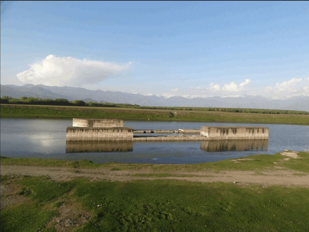
A partially built structure at the outlet of Wular Lake in north Kashmir has stood frozen since 1987, which is a mute testimony to the decades of restraint India exercised in the name of goodwill and friendship vis-a-vis Pak. The Tulbul Navigation Project, a modest navigation lock on the Jhelum at the lake’s outfall, was suspended when India halted construction in good faith following Pakistan’s objection.
Is the Calm Holding
Bashir Assad
Kashmir after Anantnag and Kulgam For much of the period following the Pahalgam attack, the most striking feature of Kashmir's security landscape was the relative absence of major attacks. That did not mean the threat had gone away. The Valley remained heavily guarded, intelligence operations continued and security agencies maintained a close watch over areas that had, at different points, been active theatres of militancy.

Economics of Inflation Crusade
Dr Mehraj Ud Din Shah
Inflation is swiftly unfolding macroeconomic fallout across the various sectors, wiping out income, savings, investment, demand, and employment, thereby giving a rude shock to the countries. The existing Inflationary phenomenon is intensively destabilizing the budget plans and regular consumption patterns of the majority of consumers across the globe, including in India.
The Other Kashmir
Sohail Bhat
Every conflict has two histories. One is recorded in military maps, diplomatic exchanges and official communiqués. The other unfolds in the everyday lives of ordinary people, where politics is experienced through schools, hospitals, employment, courts and the responsiveness of public institutions.